NSW Dept of Planning and Environment
A NSW Government website
Please use this identifier to cite or link to this item:
https://nswdpe.intersearch.com.au/nswdpejspui/handle/1/12656| Title: | The Google Earth Engine Burnt Area Map |
| Authors: | Department of Planning, Industry and Environment Environment, Energy and Science |
| Keywords: | Animals and plants;Parks reserves and protected areas |
| Issue Date: | 2020 |
| Publisher: | Department of Planning, Industry and Environment |
| Abstract: | The Google Earth Engine Burnt Area Map (Burnt Area Map also known as GEEBAM) detects how badly the tree canopy has burnt by measuring the change in the colour of vegetation before and after a fire. |
| Internal ID Number: | {1D9CD368-DC19-433C-B253-EF08DA904DFD} |
| URI: | https://nswdpe.intersearch.com.au/nswdpejspui/handle/1/12656 |
| ISBN: | 978-1-922318-37-4 |
| Appears in Collections: | Department of Planning, Industry and Environment [2019 - 2021] |
Files in This Item:
| File | Description | Size | Format | |
|---|---|---|---|---|
| factsheet-google-earth-engine-burnt-area-map-200063.pdf | factsheet-google-earth-engine-burnt-area-map-200063.pdf | 1.37 MB | Adobe PDF | 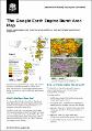 View/Open |
Items in DSpace are protected by copyright, with all rights reserved, unless otherwise indicated.