Geological Survey of NSW [1874 -present]
: [635]
Collection home page
he Geological Survey of New South Wales (GSNSW) is believed to have commenced on 16 July 1874 with the appointment of C.S. Wilkinson as Geological Surveyor initially within the Department of Lands.
From 1 July 2019 the Department of Industry was abolished and GSNSW was transferred to the new Department of Planning, Industry and Environment. GSNSW was further transferred to Regional NSW on 2 April 2020. Within Regional NSW, the GSNSW was apart of the Mining, Exploration and Geoscience (MEG) group.
In 2023, the GSNSW was undertaking a wide range of projects covering geological mapping, mineral systems studies, geophysical surveys and interpretations, basin studies, energy resource assessments, geochronology, palaeostratigraphy, database development and 3D mapping. Geophysical surveys collected included open file geophysical survey data from exploration companies. Surveys conducted included airborne magnetic and radioelement surveys, airborne electromagnetic (AEM) surveys, gravity surveys, Magnetotelluric (MT) surveys and Seismic surveys. All surveys are archived for public access following title relinquishment.
© State of New South Wales through Museums of History NSW
Collection's Items (Sorted by Submit Date in Descending order): 1 to 20 of 635
| Preview | Issue Date | Title / Name | Author(s) |
 | 1975 | A reconnaissance of the construction material resources and natural physical constraints of the Newcastle and Cessnock 1 - 100,000 sheet areas | Chesnut, W. S; Gobert, V. D;; Department of Mines; Geological Survey of NSW | |
 | 1987 | Tamworth - Hastings 1:250 000 Metallogenic Map SH5613, SH5614. Mineral deposit data sheets and metallogenic study | Gilligan, L.B.; Brownlow, J. W; Geological Survey of NSW | |
 | 2006 | Hastings 1:250 000 Geological Sheet SH/56-14 | Geological Survey of NSW | |
| 1982 | Geology and Coal Resources west of Boggabri | Geological Survey of NSW; Department of Mineral Resources; Tadros, N Z | |
 | 1981 | Records of the Geological Society of NSW | Geological Survey of NSW | |
 | 1974 | Goulburn : sheet SI 55-12 Australian National Grid | Offenberg, A. C; Geological Survey of NSW | |
 | 1873 | Geology of the tin bearing region of New England | New South Wales Legislative Council; Geological Survey of NSW | |
 | 2022 | Quarterly Notes 156 Cenozoic volcanism in New South Wales | Geological Survey of NSW | |
 | 2023 | Quarterly Notes Field guide and catalogue of Ordovician Devonian fossils from the Cargelligo and Nymagee 1:250,000 mapping areas, central New South Wales | Geological Survey of NSW | |
 | 1994 | Metallogenic studies of the Broken Hill and Euriowie Blocks, New South Wales. 3, Mineral deposits of the south-eastern Broken Hill Block | Burton, Gary R; Geological Survey of NSW | |
 | 1968 | Drilling in the State coal reserve, southern catchment area, progress report No 17, Bore D.M. Wollongong 5, | Department of Mines; Geological Survey of NSW | |
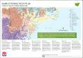 | 2021 | Fossils of the lower Hunter Valley | NSW Geological Survey; Geological Survey of NSW | |
 | 1990 | Proceedings : Southern and Western Coalfields of the Sydney Basin Workshop : 15 February 1990, the University of Wollongong | Hutton, Adrian; Depers, Aivars; Geological Survey of NSW | |
 | 1971 | Base Metal Mineralization at Mineral Hill Central Western New South Wales | McClatchie, L; Geological Survey of NSW | |
 | 1993 | The Gunnedah Basin New South Wales | Tadros, N. Z; Geological Survey of NSW; Department of Mineral Resources | |
 | 1982 | Peat in New South Wales a Position Paper Report No GS1982-222 April 1982 | Geological Survey of NSW | |
 | 1997 | Geological Survey of New South Wales Department of Mines Geological Survey Report No GS 1977-045 March 1997 | Geological Survey of NSW | |
 | 1997 | Quaternary geology of the Forster-Tuncurry coast and shelf, southeast Australia | Roy, Peter; Geological Survey of NSW | |
 | 2003 | Preparations for Third Programme of Shallow Reconnaissance Aircore Drilling Byrock Area Cobar NSW Interim Report March 2003 | Fleming, C; Hicks, M; Geological Survey of NSW | |
 | 1975 | Gold deposits of the New England fold belt | Markham, N.L; Geological Survey of NSW | |
Collection's Items (Sorted by Submit Date in Descending order): 1 to 20 of 635