Please use this identifier to cite or link to this item:
https://nswdpe.intersearch.com.au/nswdpejspui/handle/1/11863Full metadata record
| DC Field | Value | Language |
|---|---|---|
| dc.date.accessioned | 2024-06-03T03:44:50Z | - |
| dc.date.available | 2024-06-03T03:44:50Z | - |
| dc.date.issued | 1991 | en |
| dc.identifier.govdoc | {21526D5A-8D24-48BA-95C1-DA4468C25B47} | en |
| dc.identifier.uri | https://nswdpe.intersearch.com.au/nswdpejspui/handle/1/11863 | - |
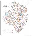
| dc.description.abstract | Kyeamba area land management plan: senstive areas | en |
| dc.language | en | en |
| dc.language | English | en |
| dc.publisher | Department of Land and Water Conservation | en |
| dc.subject | Land and soil | en |
| dc.title | Kyeamba Area Land Management Plan: Sensitive Land | en |
| dc.type | Publication | en |
| dc.type | Map | en |
| dc.contributor.corpauthor | Department of Land and Water Conservation | en |
| dc.subject.region | Murray Murrumbidgee | en |
| dc.subject.subtopic | Soil publications | en |
| dc.identifier.weburl | https://www.environment.nsw.gov.au/Research-and-publications/Publications-search/Land-and-soil/Kyeamba-Area-Land-Management-Plan-Sensitive-Land | en |
| dc.identifier.importurl | https://www.environment.nsw.gov.au/-/media/oeh/corporate-site/documents/land-and-soil/maps/map-land-management-plan-kyeamba-sensitive-land.pdf | en |
| Appears in Collections: | Department of Land and Water Conservation [1995 -2003] | |
Files in This Item:
| File | Description | Size | Format | |
|---|---|---|---|---|
| map-land-management-plan-kyeamba-sensitive-land.pdf | map-land-management-plan-kyeamba-sensitive-land.pdf | 740.76 kB | Adobe PDF |  View/Open |
Items in DSpace are protected by copyright, with all rights reserved, unless otherwise indicated.
